- Home
- Laboratories
- Remote Sensing Laboratory
Research and development of
cuttingedge remote sensing technology
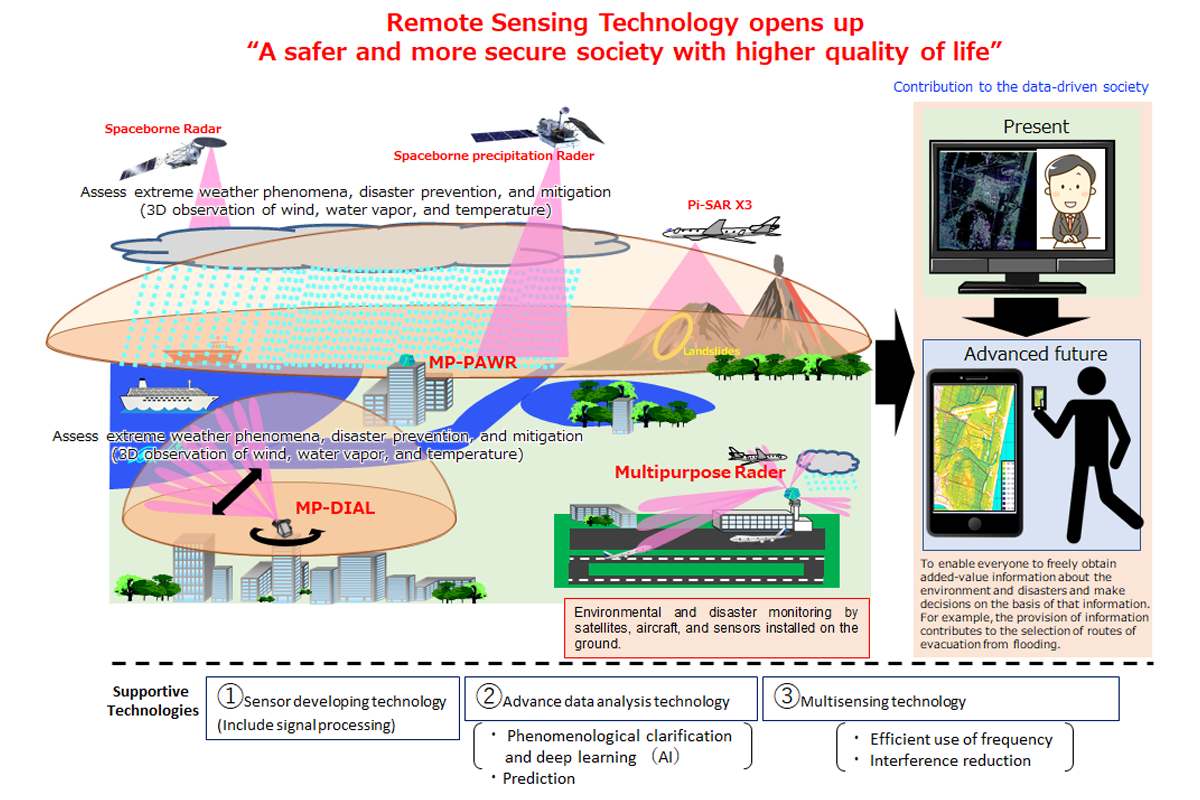
We study advanced remote sensing technology and develop instruments that can measure atmospheric wind, water vapor, and precipitation with high temporal and spatial resolutions. One of their applications is in building a system that can detect localized heavy rainfalls, so-called "guerrilla rainstorms", and tornados much earlier than the current operational systems. We also conduct research on spaceborne radars that measure global distributions of precipitation and clouds to improve accuracy in global climate/weather monitoring and forecasting.
We are, moreover, engaged in the development of an airborne synthetic aperture radar (SAR) that can produce images of ground surfaces and detect small variations in these images. Our research also includes advanced analytical techniques on SAR images. The data obtained by SAR are utilized to collect geographical information associated with natural incidents such as volcanic eruptions and earthquakes.
Director: KAWAMURA Seiji
Tasks of Remote Sensing Laboratory
Pick up researcher
Links
-
Pi-SAR Pi-SAR2 Path & Image Search
Observation data of the onboard synthetic aperture radar (SAR) are available.
-
NICT PAWR
Observation data from ground-based radar and weather sensors are available.
- Home
- Laboratories
- Remote Sensing Laboratory