Senior Researcher
AOKI MakotoPh.D. (Engineering)
Researcher, Remote Sensing Fundamentals Laboratory, Radio Research Institute After completing his doctoral degree, he worked as postdoctral researcher of Shizuoka University and joined NICT in 2014. He is engaged in reaserch of laser remote sensing and terahertz sensing. Doctor of Engineering.
- Home
- Researchers
- AOKI Makoto
Doppler lidar weather observations
Laser remote sensing of wind and rain
Introduction
Lidar (light detection and ranging) is one of the remote-sensing devices, which measures atmospheric phenomena and atmospheric components. Laser light is sent from a telescope and then the backscattered signal from the atmosphere is received by the same or another telescope. Atmospheric states are measured to analyze the backscattered signal from atmospheric molecules, airborne particles (aerosols), or clouds. Various types of lidar have been developed and studied for different purposes, such as for measuring the distance, amount of aerosol, cloud density, atmospheric temperature, wind velocity, and concentrations of carbon dioxide (CO2) and ozone (O2). The lidar is also considered to be a laser radar, which is a type of radar using laser light. NICT has been studying and developing ground-based, airborne, and spaceborne Doppler lidars that can measure the wind velocity and CO2 level for weather hazard prediction and global environmental protection.
Rider equipment
Wind observation using Doppler lidar
The laser frequency that is backscattered by atmospheric molecules, aerosols, or clouds changes slightly due to the Doppler shift. NICT has been conducting R&D on Doppler lidars that measure the wind velocity by measuring changes in frequency.
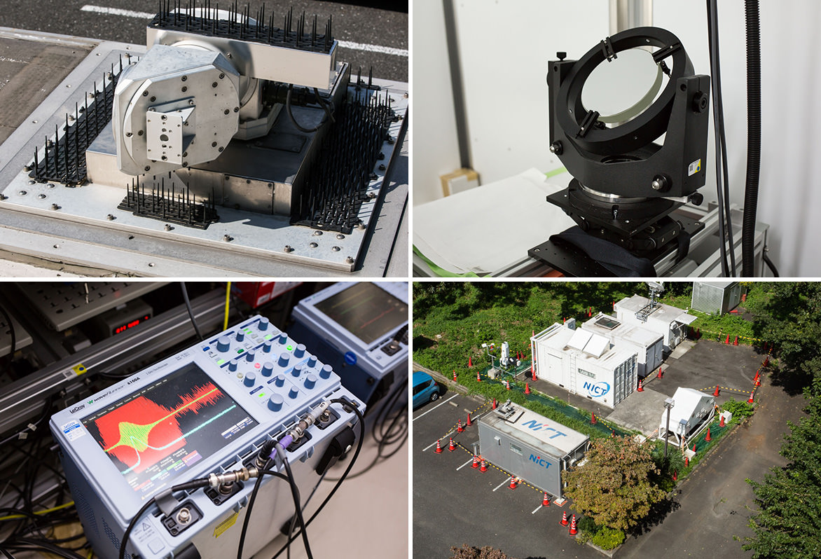
Figure 1 shows a 2-μm CO2 differential absorption Doppler lidar (CO2DIAL) developed by NICT, which is now installed in the parking area of the NICT Headquarters (Koganei, Tokyo). This Doppler lidar is set in a vehicle-borne container. Laser light is sent from a scanner installed on top of the container and is backscattered by an aerosol, and then the lidar receives it using the same scanner. Our developed laser emits eye-safe light at the wavelength of 2 μm, and we can handle light in any direction using the scanner. Figure 1 shows the plan position indicator (PPI) of the wind distribution observed on July 5, 2010, by the Doppler lidar at an elevation of 2o. The Doppler lidar installed at the center of this figure can measure the radial wind velocity as the center of it. There was heavy rain on July 5, 2010, at Itabashi-ku near the NICT Headquarters. The Doppler lidar observed strong southeast wind blowing into a well-developed cumulonimbus cloud.
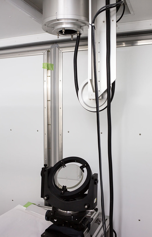
The optical reflector for outputting laser to the outdoors.
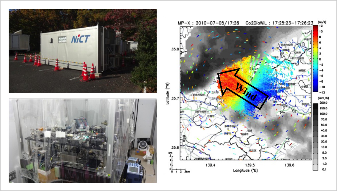
Figure 1. 2-μm CO2 differential absorption Doppler lidar (CO2DIAL) developed by NICT and wind distribution observed on July 5, 2010, by the Doppler lidar at an elevation of 2o. (Cold colors (negative wind speed) show the wind approaching the device, and warm colors (positive wind speed) show the wind moving away from the device.)
NICT installed two commercial 1.5-μm Doppler lidars as components of phased array weather radar and Doppler lidar network fusion data system (PANDA) at NICT Kobe and NICT Okinawa in March 2014 (Fig. 2). These Doppler lidars both emitted eye-safe light at a wavelength of 1.5 μm. They work in conjunction with phased array weather radar and other meteorological devices and are a part of the space meteorological data acquisition experiment system. The wind distribution observed by these Doppler lidars is combined with moisture distribution data, aerosol distribution data, and other meteorological data measured by other meteorological devices. The combined meteorological data is utilized to analyze environmental factors that generate cumulonimbus clouds and to forecast the advent of local heavy rain.
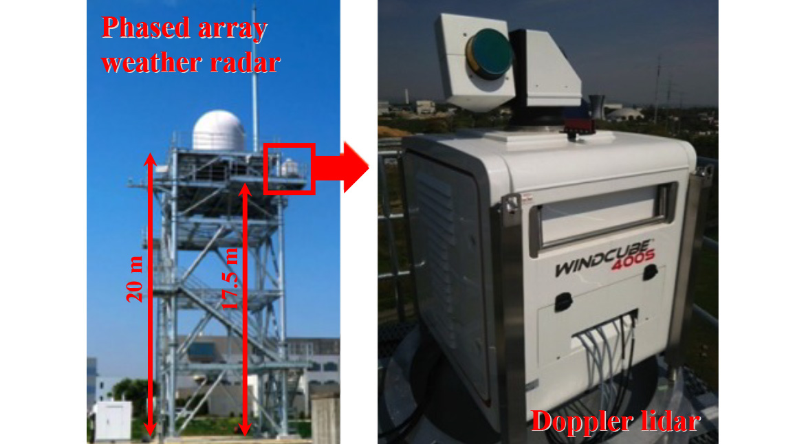
Figure 2. Phased array weather radar and Doppler lidar network fusion data system (PANDA) at NICT Kobe and NICT Okinawa and 1.5-μm Doppler lidar installed as a part of PANDA.
Rain observation using Doppler lidar
The Doppler lidar can also observe rain, although it is primarily used to measure the radial wind velocity remotely. It detects the Doppler spectrum, which has two spectrum peaks that are backscattered from the aerosol and raindrops simultaneously, when we use it to observe the vertical direction during rain events. By analyzing the double-peaked spectrum, we can detect the vertical wind and the characteristics of rain (e.g., raindrop velocity, rain intensity, and drop size distribution) at the same time. We are now conducting a comparative validation using Doppler lidars, micro rain radars, and disdrometers installed at the NICT Headquarters and NICT Okinawa. Figure 3 shows the vertical wind velocity and raindrop velocity observed on June 24, 2014, by the Doppler lidar at the NICT Headquarters. There was heavy rain (> 50 mm/h) at the NICT Headquarters and an out-of-season hailstorm at Mitaka near the NICT Headquarters. The Doppler lidar observed the downdraft caused by the rain and heavy rainfall simultaneously at 15:25. Since laser light does not spread, unlike radio waves, it is not necessary to be concerned about the extra reflection from Earth's surface and it can measure rain near the ground surface. The characteristics of rain in the lower atmosphere are as important as the ground validation of precipitation products by spaceborne precipitation radars.

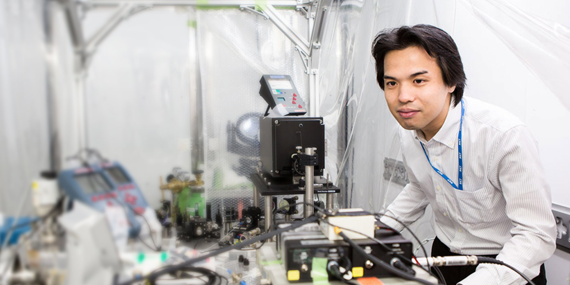
Senior Researcher Aoki carrying out research and development.
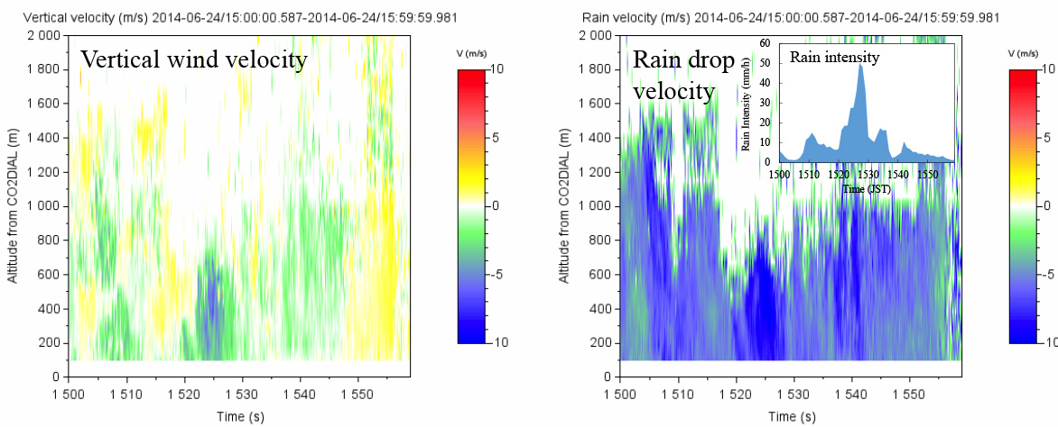
Figure 3. Vertical wind velocity and raindrop velocity observed on June 24, 2014, by the Doppler lidar at the NICT Headquarters. (Cold colors (negative wind speed) show the wind approaching the device, and warm colors (positive wind speed) show the wind moving away from the device. The inset figure on the upper right shows the rain intensity in the same time interval.)
Summary
We would like to contribute to the improvement of world weather forecasting by mounting a Doppler lidar on a satellite and observing the worldwide wind distribution. We have been carrying out basic research on airborne and spaceborne Doppler lidar platforms. Figure 4 shows the airborne 2-μm CO2DIAL developed by NICT. It can measure the CO2 levels by utilizing two lasers that have different absorption losses of CO2. In the future, we will conduct a ground validation of our developed airborne Doppler lidar and wind velocity and CO2 measurements using an airplane on which it is installed.
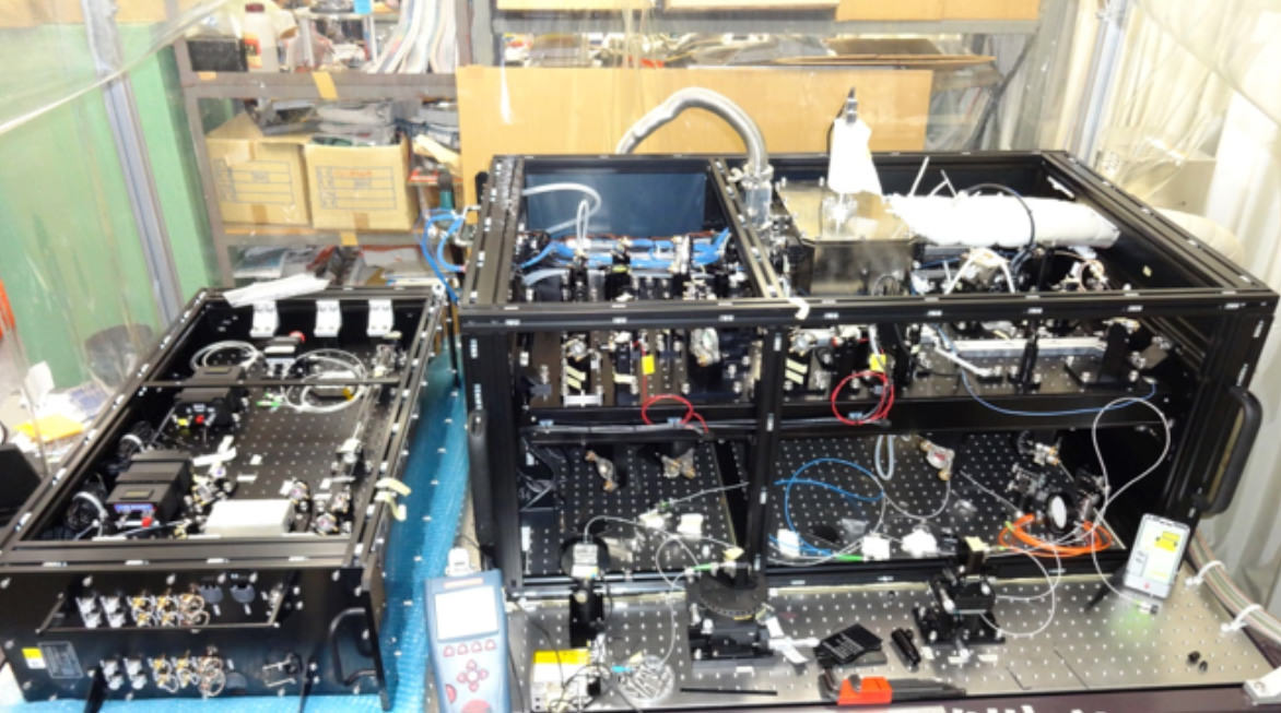
Figure 4. Airborne 2-μm CO2DIAL being developed by NICT.
Alignment of laser transmitter
- Home
- Researchers
- AOKI Makoto