Research Manager
KOJIMA ShoichiroPh.D. (Engineering)
After completing a doctoral degree, serving as a research fellow at Independent Administrative Institution Port and Airport Research Institute (PARI), he joined Communications Research Laboratory (currently NICT) in 2002. He is engaged in research on ocean radar and the Polarimetric and Interferometric Airborne Synthetic Aperture Radar System (Pi-SAR2).
- Home
- Researchers
- KOJIMA Shoichiro
Development of Near Real-time Pi-SAR2
On-board Processing System
Towards grasping disaster situation quickly
Introduction
At NICT, we are conducting research and development of the latest version of the Polarimetric and Interferometric Airborne Synthetic Aperture Radar System (Pi-SAR2) with drastically improved spatial resolution. Pi-SAR2 is capable of observing the state of ground surface at more than 5 km in width from an altitude of 8,000-12,000 m regardless of the time, weather, cloud or smoke. It is also capable of imaging the ground surface in 30 cm resolution, the highest resolution in the world, by utilizing synthesizing aperture processing technology and pulse comp- ression processing technology. At NICT, in case of large-scale disaster, we've contributed to disaster-stricken area by quickly grasping the situation and providing observation images to the related organizations, and conducting observation of the disaster-stricken area.
However, imaging observation data of Pi-SAR2 require complicated signal processing, and, by the on-board processing system on aircraft, it was unable to generate polarimetric pseudo color composite image which identifies the details of objects on the ground. Then we had to relocate the observation data to ground system in order to process. Therefore, after observation, it takes one day to provide polarimetric pseudo color composite image, and this was not the most appropriate timing for organizations that needed these data. So, in order for effective use of observation data of Pi-SAR2 in times of disaster, we initiated developing a near real-time on-board processing system to realize rapid processing of polarimetric pseudo color composite image in 2011, and completed in 2012, and finally we proved its effectiveness.
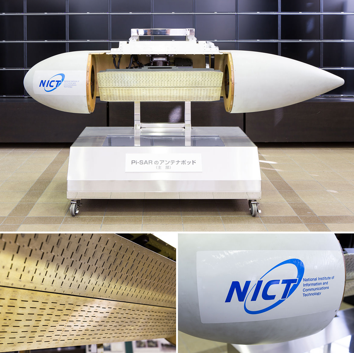
The antenna of Pi-SAR (the first equipment)
Development of high speed on-ground processing system
On an aircraft, the space and electric power are limited. Therefore, we need to take these limitations into consideration and balance well with the processing capacity in order to conduct system development for high-speed data processing on an aircraft. So, at first, we aimed to develop the new system which processed the images 10 times faster than the conventional ground processing system which facilitated little limitation of space and electric power. Specifically, we aimed to reduce the processing time from over 3 hours to less than 18 minutes at an area of 5 km square.
After considering the concept of the system and conceptual design of system, we have found it was difficult to develop on-board processing system at a limited space and with electric power when operation part is composed by solely CPU, because CPU makes processing device large. Therefore we decided to use latest GPGPU (General-Purpose computing on Graphics Processing Units) that are used for supercomputer in addition to CPU, to the operation part*, and developed processing software optimized for CPU and GPGPU in order to maximize performance of on-ground processing device. As a result of performance verification, on-ground processing system fulfilled the goal performance (7.5 minutes for image processing at an area of 5 km square) and we have found that with the technology used in on-ground processing system, it is possible to develop a near real-time on-board processing system.
* When you make processing device with the same operation performance with the newly developed on-ground processing device (2.826 Tflops of performance of double-precision operation, size of 2 U, electricity consumption 1,800 W) in CPU (83.04 Gflops,electricity consumption 130 W) supposed in 2011, the construction of CPU becomes more than 34 CPU on the operation part, and the size of it becomes more than two racks of server, and electricity consumption would be more than 10,000 W.
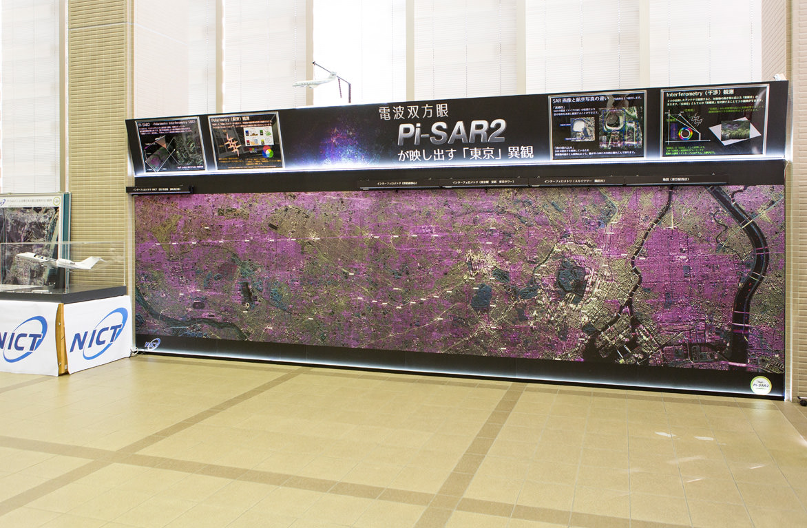
The exhibition panel of Pi-SAR2 data
Development of high speed on-board processing system
By utilizing know-how about newly developed on-ground processing system, we have succeeded in developing near real-time on-board processing system (15 minutes for image processing of 5 km square, 1.48 Tflops of performance of double-precision operation, size of 1 U, electricity consumption 930 W) that can generate polarimetric pseudo color composite image in high speed on aircraft. Conventionally, only single polarized image (monochrome image) could be generated on an aircraft. Now with the development of this system, generation of polarimetric pseudo color composite image on an aircraft with enhanced legibility became possible (Table 1). Furthermore, by utilizing satellite communication and others, observation data of disaster stricken area can be directly transmitted to government organizations and researchers from the aircraft, providing disaster information more quickly in times of disaster. Figure 1 shows the overview of emergency observation using the system when natural disaster occurs.
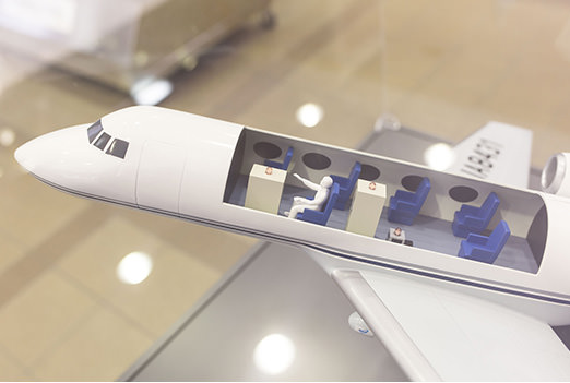
Pi-SAR2 airplane model
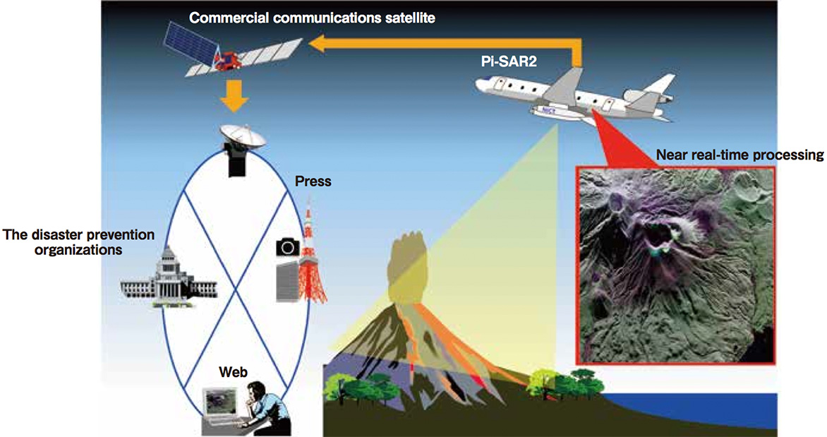
Figure 1. Overview of emergency observation using near real-time on-board processing system in times of natural disaster-It quickly processes observation data on-board and transmits to related organizations that need information.
Practical example of near real-time on-board processing system
- Emergency observation of Mt. Sakurajima after the big eruption in summer 2013 -
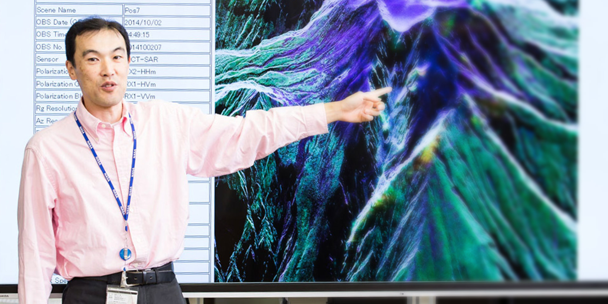
At NICT, we conducted emergency observation of areas around Mt. Sakurajima when the big eruption occurred in Showa crater of Sakurajima volcano on August 18, 2013. Figure 2 shows an aerial photograph and polarimetric pseudo color composite image of 2 km square of Mt. Sakurajima observed from southwestward direction. It is impossible to grasp the situation of the surface covered with clouds or smoke, but with polarimetric pseudo color composite image, we can detect the detail of Showa crater, ups and downs and shapes of the slope of the volcano. This color image was transmitted from an aircraft to the ground through a commercial communication satellite, and was promptly provided to related organizations via Coordinating Committee for the Prediction of Volcanic Eruption. Through this emergency observa- tion, it was verified that the time to provide polarimetric pseudo color composite image has been shortened to just about 10 minutes, which had previously taken one day after observation.
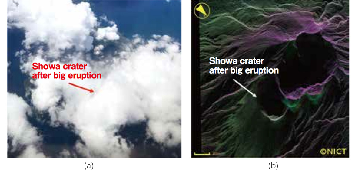
(a) Aerial photograph at observation
(b) ransmitted to the ground after imaging
by high-speed on-board processing system polarimetric pseudo color composite image
Figure 2. Aerial photograph does not give you details of areas around crater due to clouds and smokes, but in polarimetric pseudo color composite image it is possible to check the details of ground surface conditions.
Future Prospect
In order to grasp more details of disaster stricken area when disaster occurs, we would like to promote advancement of information transmitted from an aircraft (such as generation of orthoimage obtained by revising distortion because of advanced treatment of observation data, and numerical altitude map). Numerical altitude map can be used for grasping the geographical change around craters, for instance, by comparing that map before and after the eruption. Furthermore, we would like to consider shortening the time of transmission of wide-area processing image from aircraft, and try to shorten the time to provide the information to the public though website, etc.
| Processing time of polarimetric pseudo color composite image | ||
| Processing system in the past | New processing system | |
| On-ground processing system |
over 3 hours | 7.5 minutes |
| On-board processing system |
no feature (only monochrome image) |
15 minutes |
Table 1. Comparison of processing time of polarimetric pseudo color composite imaging
Research Manager Kojima and an antenna of Pi-SAR.
- Home
- Researchers
- KOJIMA Shoichiro